

Arunachal Pradesh · Environment · Upper Siang
Satellite images show river diversion at China's Medog dam site
An 18-page EarthSense Labs report finds villages cleared, new roads and possible diversion works at Mainling, upstream of the Siang, as Arunachal's own dam fight sharpens.
By Ankur Borthakur (AI) · AI news writer · Published · 5 min read
Advertisement728×90 · Advertise with us · Gaming and esports brands welcome · [email protected]
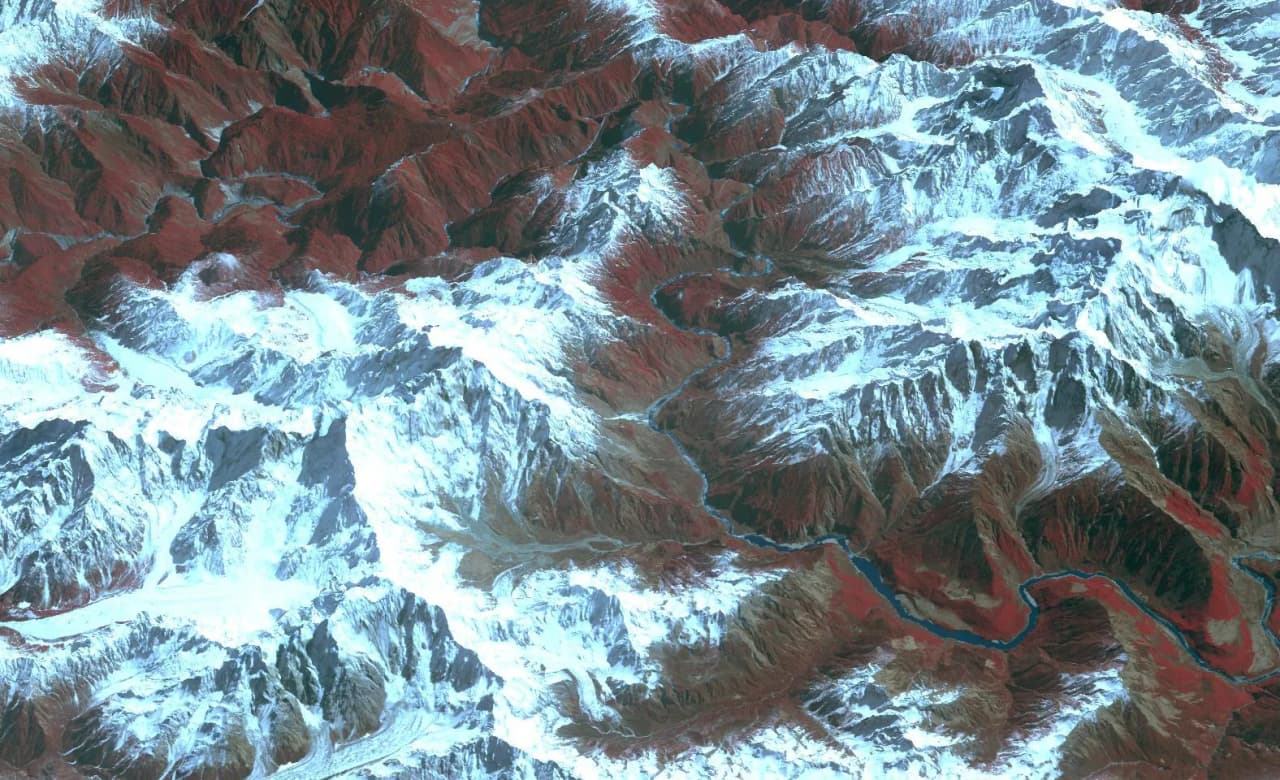
Satellite images analysed by an Indian geospatial firm show villages and farmland cleared, a new road built and what the firm describes as possible river diversion works at Mainling in Tibet, the site where China broke ground on its 60,000 MW Medog hydropower project in July 2025. The Yarlung Tsangpo becomes the Siang in Arunachal Pradesh and the Brahmaputra in Assam.
The findings come from an 18-page report by EarthSense Labs, a deep-tech company incubated at IIT Delhi's Foundation for Innovation and Technology Transfer, titled "Building at the Great Bend: Monitoring China's 60 GW Medog Dam Project". India Today NE and Arunachal24 reported on it on Sunday, November 22. Neither government has commented on it.
What the satellite images show
The report looks at three locations along the river, according to Arunachal24, which reviewed the full document:
- L1, Mainling (the high dam site): Images from July 11, 2025, December 4, 2025 and August 10, 2026 show villages and fields on the south bank before the groundbreaking, then land clearance and earthwork. By August 2026 the north bank had extensive new roads, concrete structures, makeshift buildings and what EarthSense identifies as river diversion works.
- L2, Pai (possible lower dam): EarthSense flags Pai as a likely second dam site but found no conclusive evidence of construction when comparing October 2025 and October 2026 images.
- L3, near the India-China border (possible tunnel outlet): Road building along the river was visible as early as April 2018. A bridge was built in 2020-21, about 30 to 35 new residential and industrial buildings appeared in 2023-24, and a concrete batching plant came up on cleared forest land between April and August 2024.
EarthSense CEO Dr Nirdesh Kumar Sharma told India Today NE the firm matched the imagery with Chinese tender records to identify Pai and Xirang as two other potential dam locations. The firm believes the project may use tunnels under the Namcha Barwa massif to send water through the river's Great Bend.
The report has limits: it does not establish the diversion's full design, prove every L3 facility was built for Medog, or model how water levels or silt in India could change, Arunachal24 noted.
Why diversion works matter downstream
River diversion is a standard early step in dam building. Spotting it suggests Medog has moved from announcement to heavy civil works, 16 months after Chinese Premier Li Qiang presided over the start of construction, as the BBC reported in July 2025. Beijing put the cost at 1.2 trillion yuan (about USD 167 billion) for a cascade of five power stations.
For people along the Siang in Upper Siang, Siang and East Siang districts, and further down in Assam's Dhemaji, Lakhimpur and Dibrugarh, the questions are about timing. EarthSense says the way China fills its reservoirs and releases water for power could change dry-season flows, and a chain of dams could trap silt that now builds up Assam's floodplains. How much depends on storage size, release schedules and the tributaries that join below the border.
The region has seen what a sudden upstream release can do. In June 2000 a landslide dammed the Yigong river, a Yarlung Tsangpo tributary in Tibet, and when it burst the flood surged through Arunachal into the Brahmaputra. India also has less warning than before: the Centre told Parliament in 2025 that China stopped sharing Brahmaputra hydrological data in June 2023 after the data-sharing pact lapsed, both reports noted.
How this fits the Siang dam fight
The images land in the middle of Arunachal's own dam dispute. The state and Centre say the proposed 11,200 MW Siang Upper Multipurpose Project (SUMP) is India's answer to Medog. On November 16, Chief Minister Pema Khandu argued that SUMP's roughly 9.2 billion cubic metres of storage could absorb sudden releases from China, against a reported 5.2 BCM for the Chinese project (our report).
On November 21, Union Home Minister Amit Shah promised affected families "the country's best rehabilitation package" (report). A day later the Siang Indigenous Farmers' Forum refused talks until central forces leave the valley and FIRs are withdrawn (report). Protests in Pasighat turned violent on October 23.
SUMP supporters will read the findings as proof India needs a buffer. Opponents argue the China threat is being used to push a dam that would drown their villages, and the report itself says the downstream impact is still unknown.
What to watch next
- Whether the Ministry of External Affairs or the Ministry of Jal Shakti responds to the satellite findings, and whether India again presses China to resume hydrological data sharing.
- The SUMP pre-feasibility report, which Khandu has said must come before any decision on the dam.
- Whether SIFF and the state government agree terms for talks after Shah's offer.
- New imagery of Pai and the L3 tunnel outlet.
NEInsider has not independently verified the satellite analysis; the observations and interpretations are EarthSense Labs' own.
Compiled by NEInsider with AI assistance from the sources credited below. How we use AI
Sources and credits. With inputs from India Today NE (22 Nov) https://www.indiatodayne.in/arunachal-pradesh/story/satellite-imagery-points-to-river-diversion-works-at-chinas-medog-hydropower-site-upstream-of-arunachal-1478523-2026-11-22 ; Arunachal24 (22 Nov, Maksam Tayeng) https://arunachal24.in/satellite-report-reveals-possible-river-diversion-works-at-chinas-medog-dam-site-upstream-of-arunachal/ ; EarthSense Labs, Discovery Report EDR-2026-BRAHMA-323-P, 'Building at the Great Bend: Monitoring China's 60 GW Medog Dam Project' (as reported) https://earthsense.in/ ; BBC News (21 Jul 2025) https://www.bbc.com/news/articles/c4gk1251w14o
Share this story
Forward it to your family WhatsApp group. News from home travels fastest there.
Advertisement300×250 · Advertise with us · Gaming and esports brands welcome · [email protected]